
A sub-centimetre digital twin of your estate.
Vineyard Mapping uses RTK-GIS (real-time kinematic GIS) to capture sub-centimetre-accurate positions for rows, buildings, water sources and access points. Every vine is then placed in the digital twin from row endpoints and spacing.
The product itself, an interactive digital twin that becomes the canvas every other Aurelia solution builds on, is launching in 2027. Founding partners help shape what it does.
Need a vineyard survey today?
Vineyard Mapping is launching in 2027, but the physical RTK-GIS survey behind it is a service we can run for your estate now, with full QGIS map deliverables.
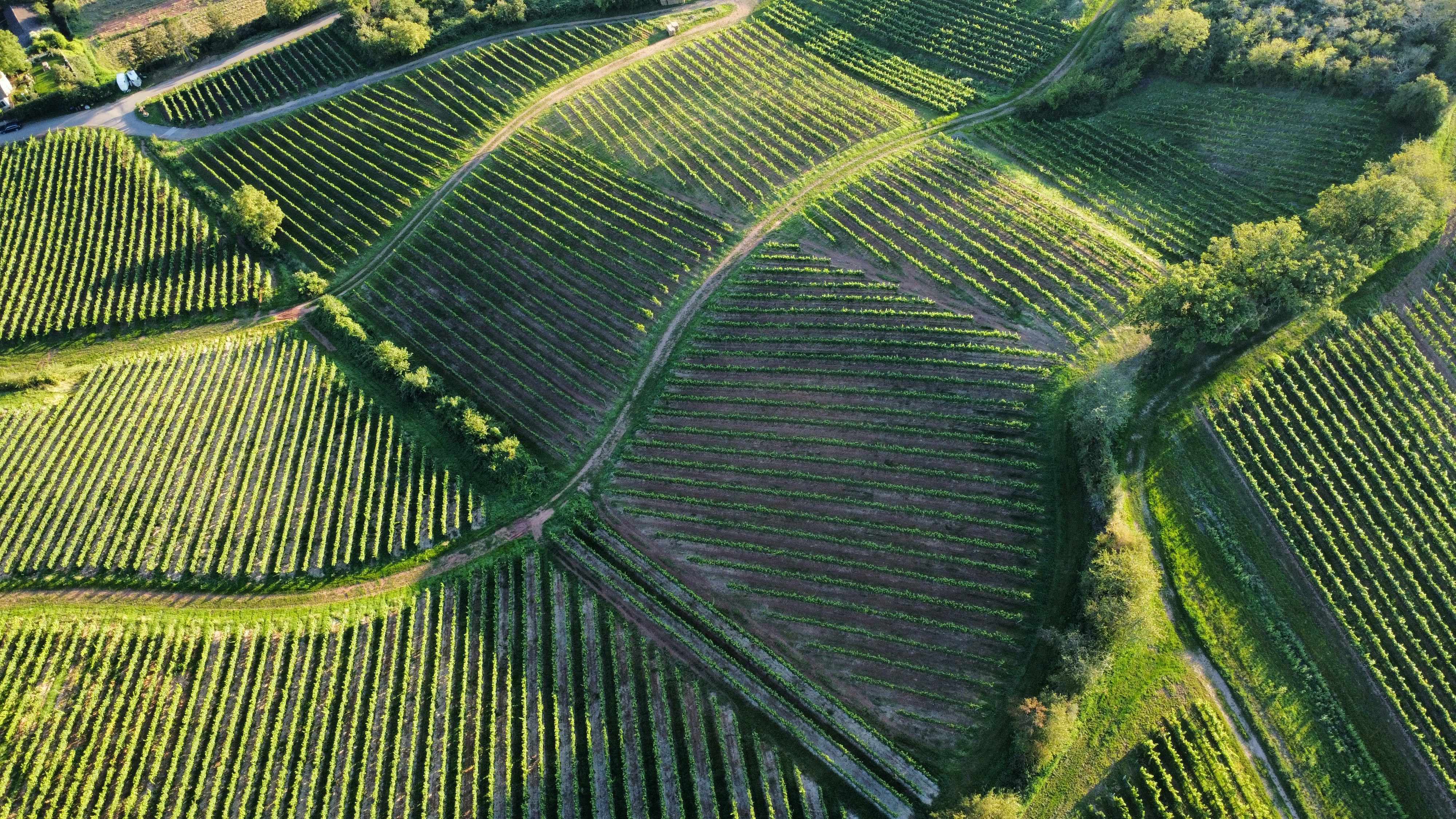
How we map your vineyard
-
Surveyed on site.
Our team comes to your estate and uses RTK-GIS equipment to capture row endpoints and key infrastructure to a few millimetres of accuracy. Hands-on, careful, and tuned to your specific terrain.
-
Every vine, mapped.
Beyond block boundaries, we derive the position of every vine from row endpoints and spacing, making vine-by-vine variability analysis possible later in the process.
-
Compatible with your stack.
We deliver the digital twin in the formats your existing viticulture and farm-management systems already use. Tell us what you run, and we will match it.
Map once. Benefit for years.
What you receive
-
Interactive digital twin
An accessible, layered map of your vineyard, updated as new data arrives. Browse by block, row or individual vine.
-
Block- and vine-level metadata
Variety, rootstock, planting year, training system, and any custom fields you maintain. Filter and query in seconds.
-
Standard exports
Map files compatible with the most common viticulture and farm management systems. Tell us what you use; we will support the format.
-
A baseline for everything else
Sensor placements, drone flight paths, AI recommendations and yield reports all reference the digital twin. Map once, benefit for years.
Benefits
-
Precision management
Target interventions to the specific blocks, rows or vines that need them.
-
Resource optimisation
Allocate water, sprays, fertiliser and labour where they will do the most good.
-
Improved planning
Make informed decisions about replanting, infrastructure changes and vineyard expansion.
-
Better record-keeping
Maintain detailed digital records of vineyard development over time.
-
Operational efficiency
Streamline workflow with clear location references for every vineyard activity.
-
Asset clarity
Document vineyard assets comprehensively for financial planning, succession or sale.
Frequently asked questions
How long does the mapping survey take?
For a typical estate of 30 to 50 hectares, the on-site survey takes one to two days, depending on terrain and access. The digital twin is delivered within two weeks of the survey.
Will it work with my existing farm management software?
Yes. We export to the standard formats used by most viticulture and farm management systems. If you use a system we have not yet integrated with, tell us; we will support the format.
Do I need to be on site during the survey?
Helpful, but not essential. If you cannot be on site, we will work from a detailed pre-survey questionnaire and follow up with you on any judgement calls.
Become a founding partner
Help shape the technology that helps shape your vineyard. Founding partners get earlier access, preferential commercials, and a direct voice in how Aurelia and Aura AI evolve.
Get Early Access